-
Events

 Eventkalender
Der Bregenzer Eventkalender beinhaltet alle Bregenzer Veranstaltungen und informiert Sie über alle Musik-, Sport- und Kulturveranstaltungen, sodass Sie keinen Termin mehr verpassen.




- Experience
- Planning
- More
-
- Events
-
Experience
- Experience
- Arts & Culture
- Lake & Mountain
- Eat & Drink
-
City & People
- City & People
-
Tourist Attractions
- Tourist Attractions
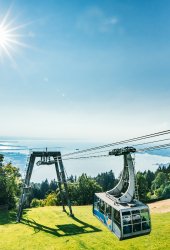
- Milchpilz Bregenz
- Fisher's Pier Bregenz
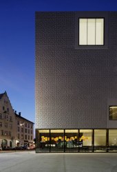
- Kunsthaus Bregenz
- Stadtführungen
- State Library Vorarlberg
- Bregenzer Seebrünzler
- Old Post Office Bregenz
- Festival House Bregenz
- Old Military Lido
- Sunset Steps at the Mole
- Bregenzer Festspiele
- vorarlberg museum
- Bregenz Harbor
- Curiosities in Bregenz
- Pfänder
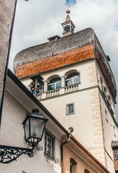
- St. Martin's Tower
- Churches in Bregenz
- Old Town Bregenz
- Guided Tours
- Shopping
- Mobile
-
Planning
- Planning
- Accommodation
- Getting Here
-
Useful Information
- Useful Information
-
Day Trips around Bregenz
- Day Trips around Bregenz
- Käsestrasse Bregenzerwald
- Theme park Ravensburger Spieleland
- Inatura Dornbirn
- The Dornier Museum Friedrichshafen
- Karren Dornbirn
- The Rolls Royce Museum Dornbirn
- Freizeitkarten
- Jewish Museum Hohenems
- Silvretta Stausee
- St. Gallen at Lake Constance
- Brandnertal Lünersee
- Zeppelin Museum Friedrichshafen
- Lindau at Lake Constance
- Schattenburg Feldkirch
- Lech Zürs am Arlberg
- Tourist Information
- Leisure & Recreation Tickets
- Brochures & Downloads
- Aqua Bregenz
- Ortstaxe
- Programs
- Further links
-
More
- More
-
Blog
- Blog
- BREGENZERLEBEN
- Experience Bregenz Festival
- Experience enjoyment
-
Experience culture
- Experience culture
- Von außen imposant - von innen interessant
- Mein Bregenz ist weltoffen
- 8 Galerien in Bregenz
- Inatura - Erlebnis Naturschau Dornbirn
- Das Leben verbraucht den Leib
- Martinsturm
- Wir haben gemeinsam viel vorwärts gebracht
- Wo die Kunst zu Hause ist
- Lichtgeschwindigkeit und dampfende Schlote
- Experience nature
- Experience sport
- Experience city
- About Us
- Press & Organizer
- Jobs & Karriere








![[Translate to English:] [Translate to English:]](/fileadmin/_processed_/b/a/csm_pexels-thirdman-5961034_20b790b97f.webp)
![[Translate to English:] [Translate to English:]](/fileadmin/_processed_/b/a/csm_pexels-thirdman-5961034_1f7b3ed7d9.jpg)


